It's been a while since my last blog, my fishing finished at the end of September, and walking became my main leisure activity. The main reason for my walks over the last few weeks has been photographing and reporting non native invasive weeds around the Bolton area for the plant tracker website.
. This has slowed down as I am running out of new places to find them.
Yesterday I went for a walk for the sake of walking. I have blogged walking the Entwistle, Wayoh and Jumbles reservoirs before but not quite the same as this.
I caught the Bolton to Blackburn bus (No 1 from stand S) from Moor Lane bus station intending to get off at Green Arms Road which runs from Blackburn Road back down to Chapeltown and gives access to Entwistle and Wayoh reservoirs. As Green Arms is a bit out in the wilds there was no bus stop until Woodlea Chase which is a good bit further on. No problem as I was looking to walk where I had not walked before, though not on a main road.
That's Woodlea Close and the start of Darwin.
But I was going this way away from Darwin.
Had not gone far when I noticed what looked like a track going off to the left.
Looked promising, and got me off the main road, got the map out and found that it went to Entwistle Station, that would do for me and there was certain to be paths going down to the reservoirs some where along it.
Easy walking on a good surfaced lane.
The Entwistle reservoir is down there somewhere in the valley.
The hill in the distance, just to the left of the tree, is Holcombe Hill which is above Bury on the way to Ramsbottom.
The first of the paths going down to the reservoir, looked OK but I decided to try further down my lane.
In the far distance is Manchester.
Zoomed in to see what is I think to tallest building in Manchester, can't remember its name.
Looking away from Entwistle. I wouldn't fancy being the farmer that lives up there.
The Witton Weavers didn't half do some walking their 'ways' are all over the place.
Looking towards Belmont and Winter Hill.
The dry stone walls on the left side of the lane look as though they have been there for a long long time.
It's got to be hard farming up here even in the summer.
I have often wondered how deep a post of this size goes into the ground.
Judging by this one it's not very far, unless this one was broken off. I looked at the bottom end of it and I don't think it was broken.
Another path to the reservoir.
To wet even for my waterproof boots, I gave it a miss.
First site of Entwistle
Somebody has been doing a bit of dry stone walling, I did put a few stones back myself as I walked. Every little helps so they say.
This looked like a good path to get me to the reservoir and so it turned out.
Although you can not see it for the leaves it is part cobbled and has a stoned base.
Must be a good reason for why it is here.
Began to think that it was going to take me all the way to the reservoir.
Until it stopped here at a flat piece of land with the remains of several buildings.
Could it have been a farm or just a barn or barns.
Although the walls and stone track stopped, off to the left was a defined grass path/lane
Which took me down towards the water.
Through the trees.
Turton & Entwistle Reservoir.
Left took me the quickest way to the dam, right to the same place just a longer walk.
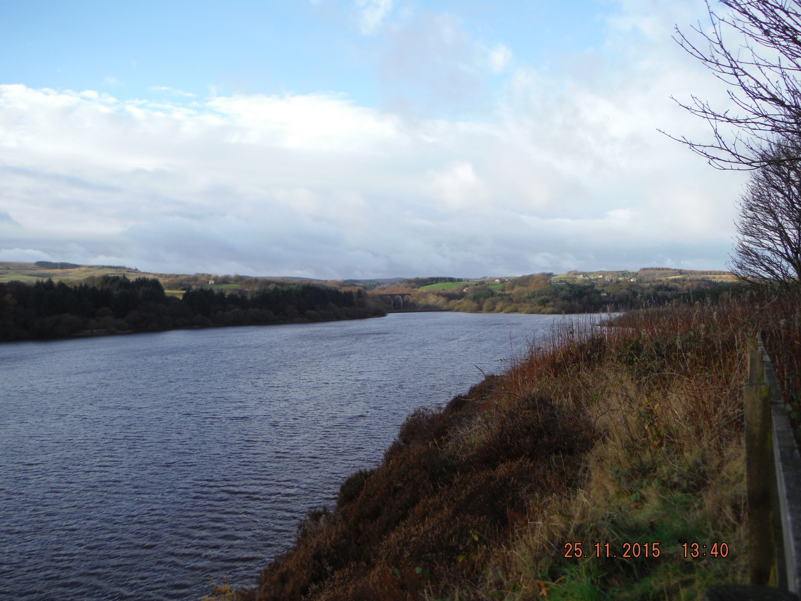
The reservoir is full to overflowing, first time for quite a while.
The overflow sends water down to the Wayoh.
Across the dam.
Not much of a sign to say when it was built.
The one for new overflow channel and valve tower in 1884 is a little fancier
At the end of the dam I went left through the lower car park.
To the path to Wayoh.
A good dry path all the way down.
The overflow from Entwistle.
Quite steep at times but no problem with a little care.
The rail bridge over Bradshaw Brook that was built in 1848 some time before the reservoir which was finished in1876.
The path takes you through the arches of which there are 7 or is it 8, old age!!!!
I never fail to wonder how all this stone got to here and how they managed to build this magnificent bridge out in the middle of nowhere.
Almost down.
Again a choice, go right the short way or left across the dam for the long one.
This time I went the long way.
You get a better view of the bridge.
Looking towards the main dam.
The path then takes you to another dam with Crow Trees Lane going over it.
Crow Trees Lane.
The lane would take you to Edgworth but I go right and stay with the reservoir.
Again a good path but with one quite steep climb.
and one muddy bit.
At the top of the climb you can go across the field to the left towards Edgerton
or stay with Wayoh passed the notice board.
Looking back towards the rail bridge.
The dam looking towards Turton Bottoms.
50% of Bolton water is treated at the plant at the bottom of the dam. I don't know where the rest comes from, must find out.
I was expecting that this wonder of an overflow would be in full flow but not to be.
Even if the overflow would be in full flow I think this is more than a little over the top.
Back across the dam I went
English support for the French, never mind the Scots, Welsh and Irish.
The amount of this on the dam is disgusting. The dog owners of Edgerton should be ashamed.
The crochet person to be applauded.
Up passed the Black Bull or into it for refreshment.
Down the hill into Turton Bottoms.
another possible stop for drinks or food.
over the bridge and round the corner
and left down Vale Street until you come to the brook.
then right down by the water.
Gets a bit muddy in places.
Traces of an old goit from before Jumbles was built.
and a bit more of it.
The beginning of Jumbles Reservoir.
This bridge at the top end of Jumbles means that you can walk around the reservoir. Most people start at the car park and cafe which is at the dam end.
Across the bridge is the longer route I took the path to the left.
Which is a pleasant level path that takes you to the cafe car park and toilets.
unlike the other two reservoirs Jumbles is quite new and was only opened by the Queen in 1971
across the car park
to a path that takes you down to Bradshaw Brook
At the bottom you have three choices, first left takes you up hill to above Bradshaw Fisheries and on to Bradshaw Road. The middle route follows Bradshaw Brook were I went, whilst crossing the brook takes you up a steep hill to Grange Road leading to Shady Lane and the Turton Darwin Road
I followed the brook
which brought me to the Bradshaw Hall Estate and Bradshaw Road and home.